 FARM & FOOD CARE ONTARIO
Annual Conference
Thursday, April 13, 2017
Royal Botanical Gardens, Burlington
Featuring:
“Is Gwyneth Paltrow wrong about everything? When celebrity
culture and science clash”
Keynote address by Dr. Timothy Caulfield, Professor, Faculty of
Law and the School of Public Health, University of Alberta
“The politics of food”
Dr. Evan Fraser, Canada Research Chair (Tier I) in Global Food
Security, Department of Geography, University of Guelph
“Ask the millennials”
A consumer panel discussion on issues related to food and farming
as seen through the perspective of university student leaders
And much more...
Registration fee: Ontario farmers - $100; Industry/Government/Academia - $150
(before March 15). Registration fee increases by $50 after March 15.
Register or get more details online at www.FarmFoodCareON.org
SATELLITE
IMAGERY
meet the limitations of the equip-
ment. There is a place for both
high-resolution imagery for under-
standing very detailed responses in
the field, and less-detailed imagery
looking for trends in the field for
zone management purposes.”
Conclusions
Satellite imagery is finding a place in
many areas of the agricultural industry.
Government groups, provincial
groups, academia, agricultural
insurance companies and industry
organizations and participants use
satellite imagery for data collection,
says Davidson.
Schacht also notes the uses of this
imagery. “Agricultural (commodity
analysts) have been interested in the
imagery. They use the data to assess
global yields and crop supplies.”
Crop insurers have also been
considering the benefits of the data.
“They are looking into automating
claims. They could pick (weather
damage) on the imagery such as
where the damage happened and how
much,” says Schacht. “It’s a big time
and cost saver.”
Schacht even has a customer who is
now looking into using the imagery to
automate an irrigation system.
It seems the possibilities for the use
of satellite imagery for Ontario`s farm-
ers continue to evolve.
BF
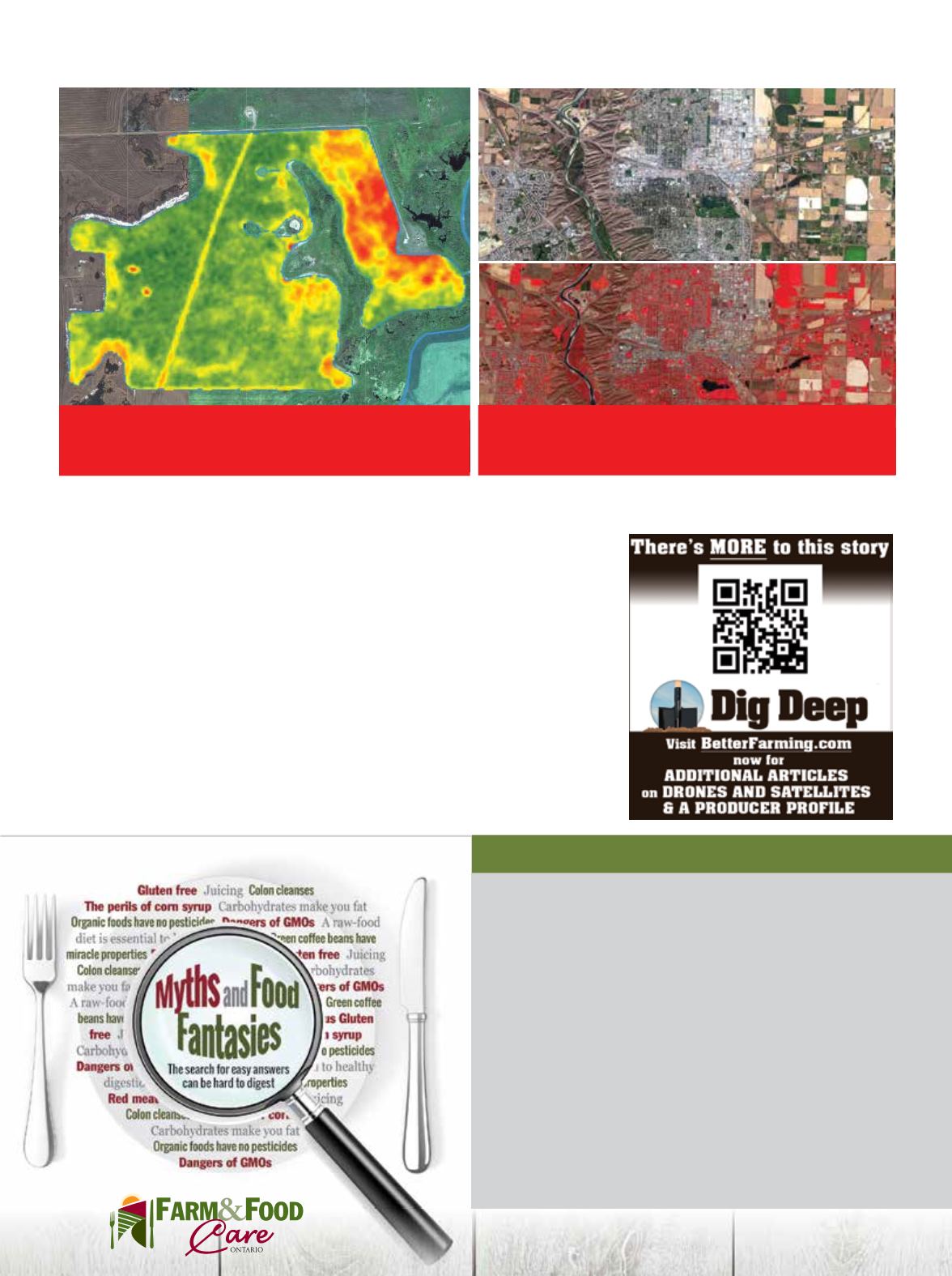
With applications such as this health map, data
from the NDVI of a field is digitally translated into
simple colour zones for easier interpretation.
With near-infrared images, dense green vegetation
reflects the infrared light, shown on the image as
red. This image shows Lethbridge, Alberta in 2015.
Planet Labs Inc photo
Richard Marsh, Farmers Edge photo


